Old Boundary Marker by the former A367, Bath Road, Red Post, Peasedown St John
Introduction
The photograph on this page of Old Boundary Marker by the former A367, Bath Road, Red Post, Peasedown St John by Alan Rosevear as part of the Geograph project.
The Geograph project started in 2005 with the aim of publishing, organising and preserving representative images for every square kilometre of Great Britain, Ireland and the Isle of Man.

There are currently over 7.5m images from over 14,400 individuals and you can help contribute to the project by visiting https://www.geograph.org.uk
Old Boundary Marker by the former A367, Bath Road, Red Post, Peasedown St John
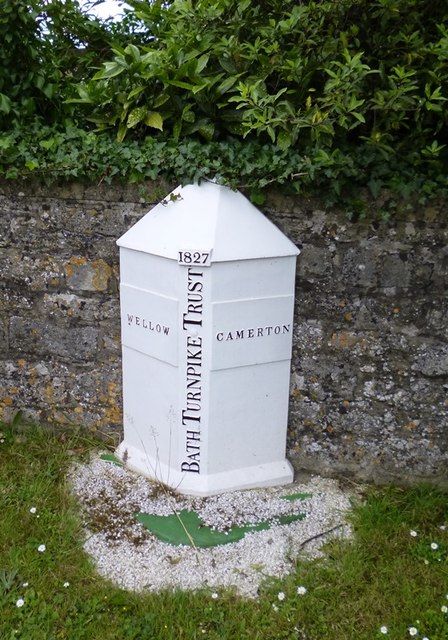
Image: © Alan Rosevear Taken: 24 Jun 2013
Parish Boundary Marker - Turnpike by the UC (was A367), in parish of Peasedown St John (Bath and North East Somerset District), Red Post Inn, Bath Road, junction with Wellow Lane, on verge in front of stone wall to right of pub. Inscription reads:- : WELLOW : : 1827 / BATH TURNPIKE TRUST (vertical) : : CAMERTON : Grade II listed. List Entry Number: 1129504 https://historicengland.org.uk/listing/the-list/list-entry/1129504 Surveyed Milestone Society National ID: SO_BARA05pb
Images are licensed for reuse under creativecommons.org/licenses/by-sa/2.0
Image Location
Latitude
51.312568
Longitude
-2.433816