Old Boundary Marker by the A11, Bow Road E3
Introduction
The photograph on this page of Old Boundary Marker by the A11, Bow Road E3 by Milestone Society as part of the Geograph project.
The Geograph project started in 2005 with the aim of publishing, organising and preserving representative images for every square kilometre of Great Britain, Ireland and the Isle of Man.

There are currently over 7.5m images from over 14,400 individuals and you can help contribute to the project by visiting https://www.geograph.org.uk
Old Boundary Marker by the A11, Bow Road E3
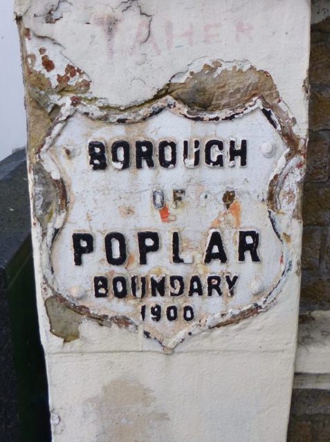
Image: © Milestone Society Taken: Unknown
Municipal Boundary Marker by the A11, in parish of Poplar (Tower Hamlets District), Bow Road E3, on pier next to pharmacy 50m East of junction with Brokesley Street. Metal plate faces West along Bow Road. Inscription reads:- : BOROUGH / OF / POPLAR / BOUNDARY / 1900 : Surveyed Milestone Society National ID: MX_POPL01pb.
Images are licensed for reuse under creativecommons.org/licenses/by-sa/2.0
Image Location
Latitude
51.525945
Longitude
-0.030289