Old Direction Sign - Signpost by Birchwood Road, Cock Clarks
Introduction
The photograph on this page of Old Direction Sign - Signpost by Birchwood Road, Cock Clarks by Milestone Society as part of the Geograph project.
The Geograph project started in 2005 with the aim of publishing, organising and preserving representative images for every square kilometre of Great Britain, Ireland and the Isle of Man.

There are currently over 7.5m images from over 14,400 individuals and you can help contribute to the project by visiting https://www.geograph.org.uk
Old Direction Sign - Signpost by Birchwood Road, Cock Clarks
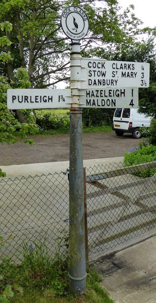
Image: © Milestone Society Taken: Unknown
Disc finial - 3 arms; Progress Foundry Ltd, by the UC road, in parish of Purleigh (Maldon District), Cock Clarks, junction of Birchwood Road with Chimney Pot Lane, on grass verge, by drive. Surveyed Milestone Society National ID: EX_TL8102B.
Images are licensed for reuse under creativecommons.org/licenses/by-sa/2.0
Image Location
Latitude
51.694233
Longitude
0.625141