Old Guide Stone by the A431, Bath Road, Bitton Parish
Introduction
The photograph on this page of Old Guide Stone by the A431, Bath Road, Bitton Parish by Mike Faherty as part of the Geograph project.
The Geograph project started in 2005 with the aim of publishing, organising and preserving representative images for every square kilometre of Great Britain, Ireland and the Isle of Man.

There are currently over 7.5m images from over 14,400 individuals and you can help contribute to the project by visiting https://www.geograph.org.uk
Old Guide Stone by the A431, Bath Road, Bitton Parish
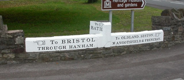
Image: © Mike Faherty Taken: 8 Oct 2010
By the A431, in parish of Bitton (South Gloucestershire District), Bath Road junction with Cherry Garden Road (A4175), on low wall. Surveyed Milestone Society National ID: GL_BRBA05SB
Images are licensed for reuse under creativecommons.org/licenses/by-sa/2.0
Image Location


Leaflet Map data © OpenStreetMap
Latitude
51.4294
Longitude
-2.472565