Old Milestone by the former A635, Saltersbrook Road, Darfield Parish
Introduction
The photograph on this page of Old Milestone by the former A635, Saltersbrook Road, Darfield Parish by C Minto as part of the Geograph project.
The Geograph project started in 2005 with the aim of publishing, organising and preserving representative images for every square kilometre of Great Britain, Ireland and the Isle of Man.

There are currently over 7.5m images from over 14,400 individuals and you can help contribute to the project by visiting https://www.geograph.org.uk
Old Milestone by the former A635, Saltersbrook Road, Darfield Parish
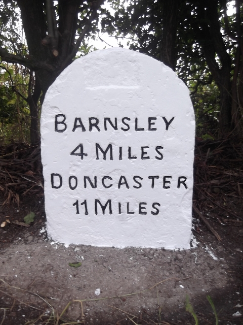
Image: © C Minto Taken: 1 Jan 1992
Carved stone post by the former A635, in parish of DARFIELD (BARNSLEY District), West end of Darfield near Garden Centre, on what is now a short link road, 150m East of junction with Saltersbrook Road, on the verge, under hedge, on East side of road. Road re-aligned mid 20th century leaving milestone in its original location. Erected by the Doncaster & Salter's Brook turnpike trust in the 18th/19th century. Inscription reads:- BARNSLEY 4 MILES DONCASTER 11 MILES Grade II listed. List Entry Number: 1287062 https://historicengland.org.uk/listing/the-list/list-entry/1287062 Milestone Society National ID: YS_DNBN11.
Images are licensed for reuse under creativecommons.org/licenses/by-sa/2.0
Image Location
Latitude
53.541981
Longitude
-1.389008