Old Boundary Marker by the former A429, Warwick Road, Kenilworth
Introduction
The photograph on this page of Old Boundary Marker by the former A429, Warwick Road, Kenilworth by Milestone Society as part of the Geograph project.
The Geograph project started in 2005 with the aim of publishing, organising and preserving representative images for every square kilometre of Great Britain, Ireland and the Isle of Man.

There are currently over 7.5m images from over 14,400 individuals and you can help contribute to the project by visiting https://www.geograph.org.uk
Old Boundary Marker by the former A429, Warwick Road, Kenilworth
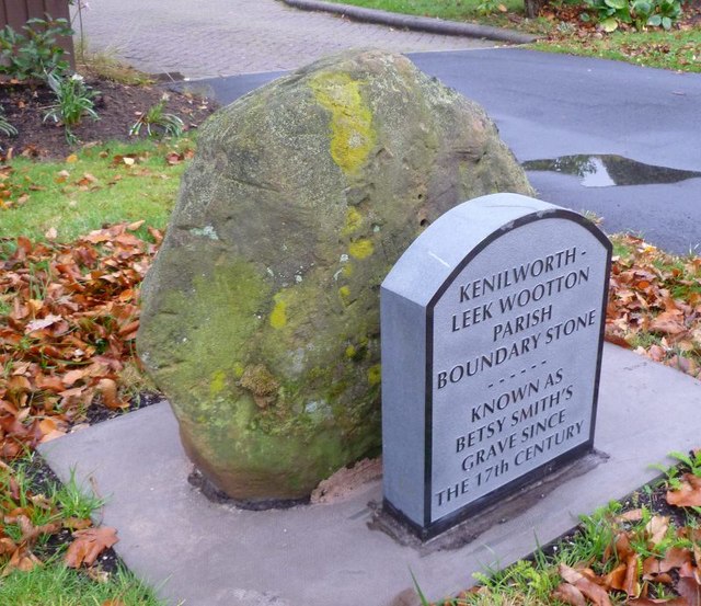
Image: © Milestone Society Taken: Unknown
Parish Boundary Marker by the UC (was A429), in parish of Kenilworth (Warwick District), Warwick Road, opposite the junction with Rouncil Lane on verge. Known as Betsy Smith's Grave. Surveyed Milestone Society National ID: WA_KENLEK01pb.
Images are licensed for reuse under creativecommons.org/licenses/by-sa/2.0
Image Location
Latitude
52.333104
Longitude
-1.573344