Old Milestone north of Sandford
Introduction
The photograph on this page of Old Milestone north of Sandford by T Jenkinson as part of the Geograph project.
The Geograph project started in 2005 with the aim of publishing, organising and preserving representative images for every square kilometre of Great Britain, Ireland and the Isle of Man.

There are currently over 7.5m images from over 14,400 individuals and you can help contribute to the project by visiting https://www.geograph.org.uk
Old Milestone north of Sandford
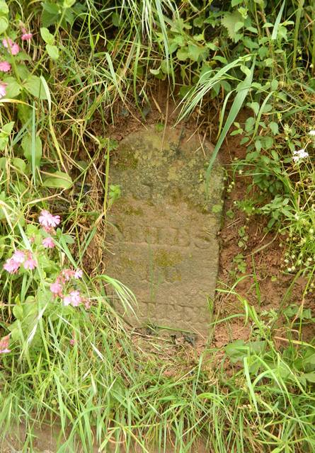
Image: © T Jenkinson Taken: 17 Feb 2009
Carved stone post by the UC road, in parish of SANDFORD (MID DEVON District), 30m South of Sturridge & Hare House, 600m North of Orchard Close, buried in side bank, under vegetation, on East side of road. Exeter tombstone, erected by the Exeter turnpike trust in the 19th century. Inscription reads:- 10 MILES TO EXETER Milestone Society National ID: DV_EXSM10.
Images are licensed for reuse under creativecommons.org/licenses/by-sa/2.0
Image Location
Latitude
50.816414
Longitude
-3.665829