Old Milestone by the A674, Chorley Road, Ollerton
Introduction
The photograph on this page of Old Milestone by the A674, Chorley Road, Ollerton by C Marcus as part of the Geograph project.
The Geograph project started in 2005 with the aim of publishing, organising and preserving representative images for every square kilometre of Great Britain, Ireland and the Isle of Man.

There are currently over 7.5m images from over 14,400 individuals and you can help contribute to the project by visiting https://www.geograph.org.uk
Old Milestone by the A674, Chorley Road, Ollerton
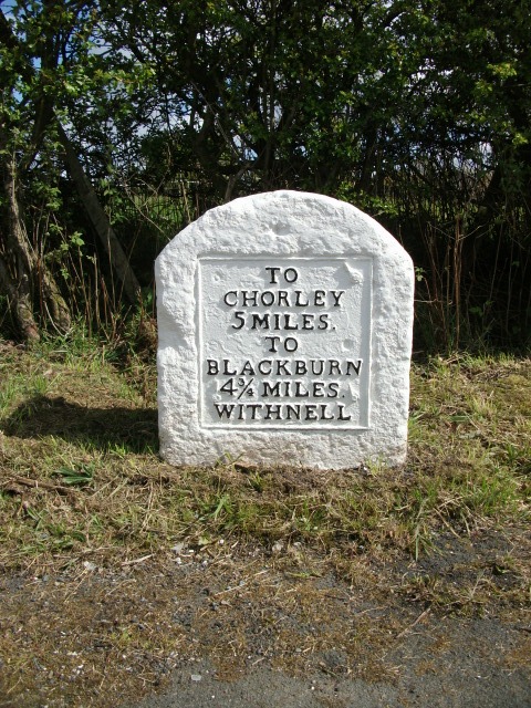
Image: © C Marcus Taken: 1 Apr 2008
Metal plate attached to stone post by the A674, in parish of WITHNELL (CHORLEY District), Ollerton, junction with Bury Lane, on South side of road. Chorley plate, erected by the Chorley to Blackburn turnpike trust in the 19th century. Inscription reads:- TO CHORLEY 5 MILES. TO BLACKBURN 4¾ MILES. WITHNELL Milestone Society National ID: LA_CYBB05.
Images are licensed for reuse under creativecommons.org/licenses/by-sa/2.0
Image Location
Latitude
53.707646
Longitude
-2.570334