Old Milestone by the A3066/A356, Turnpike Cross, east of Misterton
Introduction
The photograph on this page of Old Milestone by the A3066/A356, Turnpike Cross, east of Misterton by Milestone Society as part of the Geograph project.
The Geograph project started in 2005 with the aim of publishing, organising and preserving representative images for every square kilometre of Great Britain, Ireland and the Isle of Man.

There are currently over 7.5m images from over 14,400 individuals and you can help contribute to the project by visiting https://www.geograph.org.uk
Old Milestone by the A3066/A356, Turnpike Cross, east of Misterton
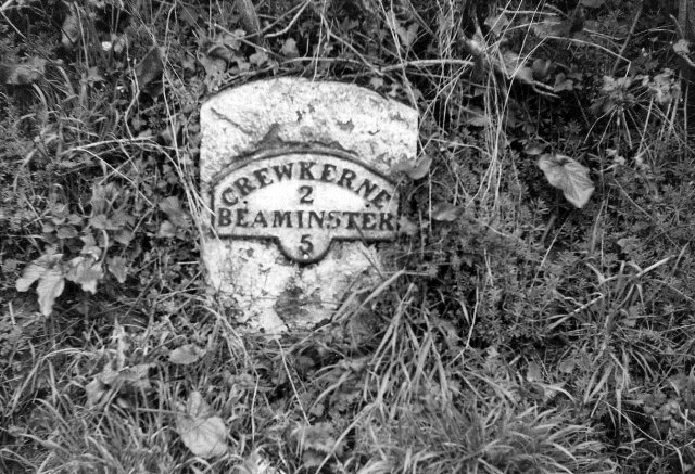
Image: © Milestone Society Taken: Unknown
Beaminster iron plate by the A3066, in parish of Misterton (South Somerset District), near Well Spring Farm, by the road. Inscription once read:- : (CREWKERNE / 2 / BEAMINSTER / 5) : Junction widened and stone lost since 1970. Milestone Society National ID: SO_CWBE02.
Images are licensed for reuse under creativecommons.org/licenses/by-sa/2.0
Image Location
Latitude
50.868077
Longitude
-2.767463