Old Milestone by Howgill Lane, Howgill
Introduction
The photograph on this page of Old Milestone by Howgill Lane, Howgill by Milestone Society as part of the Geograph project.
The Geograph project started in 2005 with the aim of publishing, organising and preserving representative images for every square kilometre of Great Britain, Ireland and the Isle of Man.

There are currently over 7.5m images from over 14,400 individuals and you can help contribute to the project by visiting https://www.geograph.org.uk
Old Milestone by Howgill Lane, Howgill
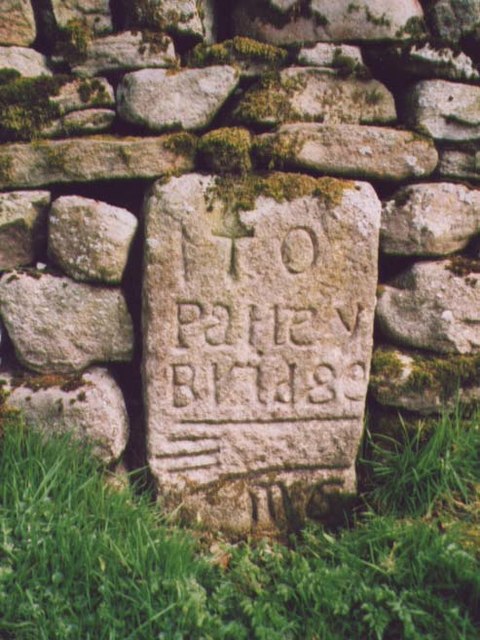
Image: © Milestone Society Taken: Unknown
By Howgill Lane track, in parish of Appletreewick (Craven District), Howgill North of Barden Bridge, Howgill Lane, set in wall opposite FP to Skyreholme. Inscription reads:- : To / Pateley / Bridge / {pointing hand} / M 6 : Surveyed Milestone Society National ID: YN_XHOW.
Images are licensed for reuse under creativecommons.org/licenses/by-sa/2.0
Image Location
Latitude
54.03046
Longitude
-1.90226