Old Boundary Marker by the B450
Introduction
The photograph on this page of Old Boundary Marker by the B450 by Milestone Society as part of the Geograph project.
The Geograph project started in 2005 with the aim of publishing, organising and preserving representative images for every square kilometre of Great Britain, Ireland and the Isle of Man.

There are currently over 7.5m images from over 14,400 individuals and you can help contribute to the project by visiting https://www.geograph.org.uk
Old Boundary Marker by the B450
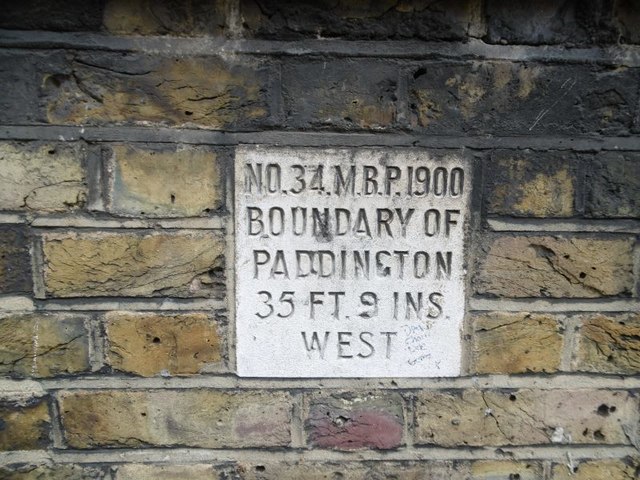
Image: © Milestone Society Taken: Unknown
Municipal Boundary Marker by the B450, in parish of Paddington Bayswater And Knightsbridge (City Of Westminster District), Kilburn Lane W10, just N of church entrance in wall. Inscription reads:- : NO.34.M.B.P.1900 / BOUNDARY OF / PADDINGTON / 35 FT. 9 INS. / WEST : Surveyed Milestone Society National ID: MX_PADDB34pb.
Images are licensed for reuse under creativecommons.org/licenses/by-sa/2.0
Image Location
Latitude
51.528378
Longitude
-0.216017