Old Milestone by the A645, Knottingley
Introduction
The photograph on this page of Old Milestone by the A645, Knottingley by C Minto as part of the Geograph project.
The Geograph project started in 2005 with the aim of publishing, organising and preserving representative images for every square kilometre of Great Britain, Ireland and the Isle of Man.

There are currently over 7.5m images from over 14,400 individuals and you can help contribute to the project by visiting https://www.geograph.org.uk
Old Milestone by the A645, Knottingley
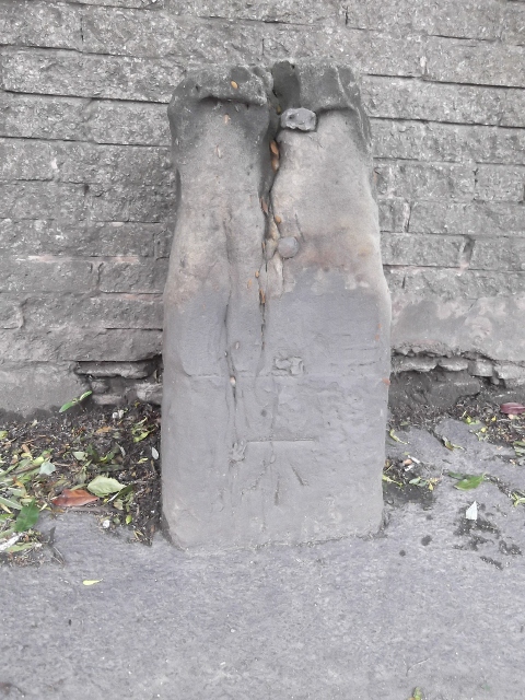
Image: © C Minto Taken: 21 May 2003
Stone post (plate lost) by the A645, in parish of KNOTTINGLEY (WAKEFIELD District), Knottingley, between two bridges over Aire and Calder Canal; opposite St Michael's Catholic Church, on pavement, back to wall near "Amphitheatre", on South side of road. Erected by the Wakefield & Weeland turnpike trust in the 18th/19th century. Inscription once read:- (PONT) (3) (WAKD) (12) Carved benchmark on front below plate. Milestone Society National ID: YW_WKWL12.
Images are licensed for reuse under creativecommons.org/licenses/by-sa/2.0
Image Location
Latitude
53.709511
Longitude
-1.246248