Old Milestone by the A420, High Street, Wick
Introduction
The photograph on this page of Old Milestone by the A420, High Street, Wick by M Faherty as part of the Geograph project.
The Geograph project started in 2005 with the aim of publishing, organising and preserving representative images for every square kilometre of Great Britain, Ireland and the Isle of Man.

There are currently over 7.5m images from over 14,400 individuals and you can help contribute to the project by visiting https://www.geograph.org.uk
Old Milestone by the A420, High Street, Wick
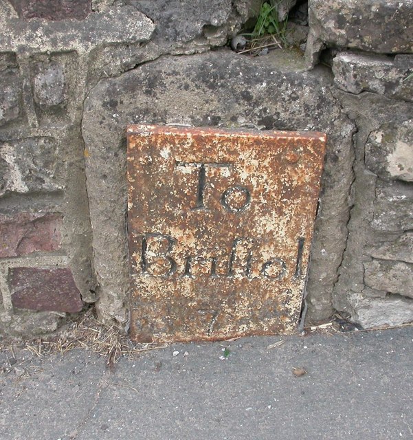
Image: © M Faherty Taken: 7 Apr 2010
Metal plate attached to stone post by the A420, in parish of WICK AND ABSON (SOUTH GLOUCESTERSHIRE District), High Street, Wick. Inset into wall of No. 59, on North side of road. Bristol incised iron plate, erected by the Bristol turnpike trust in the 18th century. Inscription reads:- To Bristol 7 Grade II listed. List Entry Number: 1216418 https://historicengland.org.uk/listing/the-list/list-entry/1216418 Milestone Society National ID: GL_BRCP07.
Images are licensed for reuse under creativecommons.org/licenses/by-sa/2.0
Image Location


Leaflet Map data © OpenStreetMap
Latitude
51.45251
Longitude
-2.425356