Old Wayside Cross near Challabrook Farm, Bovey Tracey
Introduction
The photograph on this page of Old Wayside Cross near Challabrook Farm, Bovey Tracey by Alan Rosevear as part of the Geograph project.
The Geograph project started in 2005 with the aim of publishing, organising and preserving representative images for every square kilometre of Great Britain, Ireland and the Isle of Man.

There are currently over 7.5m images from over 14,400 individuals and you can help contribute to the project by visiting https://www.geograph.org.uk
Old Wayside Cross near Challabrook Farm, Bovey Tracey
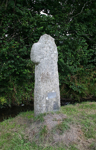
Image: © Alan Rosevear Taken: 14 Aug 2009
Cavalier Cross (Longstone or Challabrook Cross), old head, shaft and base, Starkey No.80 by the green lane, in parish of Bovey Tracey (Teignbridge District), on the public footpath leading from the by-pass, about 350m North East of Challabrook Farm, in the grass beside the brook, just before the farm gate. Grade II listed. List Entry Number: 1165056 https://historicengland.org.uk/listing/the-list/list-entry/1165056 Surveyed Milestone Society National ID: DVTE_BOV01.
Images are licensed for reuse under creativecommons.org/licenses/by-sa/2.0
Image Location
Latitude
50.588034
Longitude
-3.682689