Private house in Ganllwyd
Introduction
The photograph on this page of Private house in Ganllwyd by John Lucas as part of the Geograph project.
The Geograph project started in 2005 with the aim of publishing, organising and preserving representative images for every square kilometre of Great Britain, Ireland and the Isle of Man.

There are currently over 7.5m images from over 14,400 individuals and you can help contribute to the project by visiting https://www.geograph.org.uk
Private house in Ganllwyd
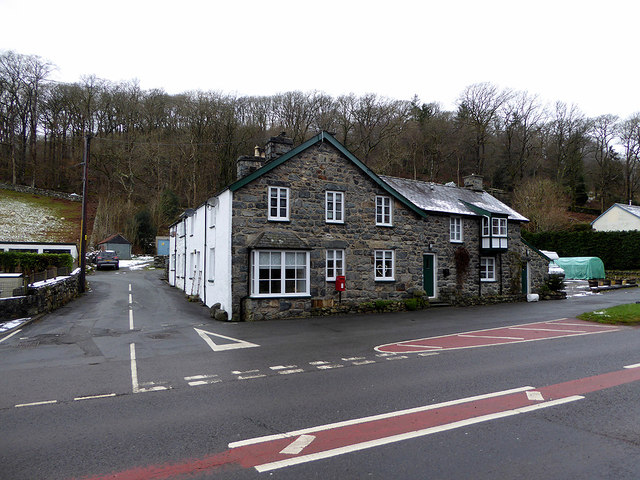
Image: © John Lucas Taken: 23 Jan 2019
Viewed from the bus shelter. As I waited for the next bus, the look of this building gave the impression that it had a previous use. Firstly I thought that it might have been an inn but inspection of old maps showed that it had been the Ganllwyd post office and is marked as such on the 1889 25" map. A datestone on the gable carries the date 1866. A postbox still stands by the building, marking its previous use.
Images are licensed for reuse under creativecommons.org/licenses/by-sa/2.0
Image Location
Latitude
52.803793
Longitude
-3.889952