Old Milestone by the A28, Ashford Road, Tenterden Parish
Introduction
The photograph on this page of Old Milestone by the A28, Ashford Road, Tenterden Parish by C Woodward as part of the Geograph project.
The Geograph project started in 2005 with the aim of publishing, organising and preserving representative images for every square kilometre of Great Britain, Ireland and the Isle of Man.

There are currently over 7.5m images from over 14,400 individuals and you can help contribute to the project by visiting https://www.geograph.org.uk
Old Milestone by the A28, Ashford Road, Tenterden Parish
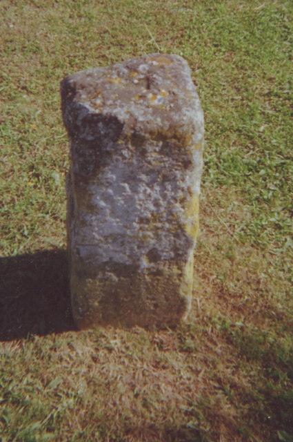
Image: © C Woodward Taken: 17 Jul 2008
Stone post (plate lost) by the A28, in parish of TENTERDEN (ASHFORD District), Ashford Road; at junction with Chalk Avenue, on bund forming verge, on West side of road. Tenterden marker, erected by the Bethersden turnpike trust in the 19th century. Inscription once read:- (Ashford 11) (Tenterden 1) Kent HER listed. HER Number: TQ 83 SE 285 https://www.heritagegateway.org.uk/Gateway/Results_Single.aspx?uid=MKE78196&resourceID=1005 Milestone Society National ID: KE_TTAF02.
Images are licensed for reuse under creativecommons.org/licenses/by-sa/2.0
Image Location
Latitude
51.080646
Longitude
0.694651