Old Direction Sign - Signpost by the B3286, Camborne Parish
Introduction
The photograph on this page of Old Direction Sign - Signpost by the B3286, Camborne Parish by Milestone Society as part of the Geograph project.
The Geograph project started in 2005 with the aim of publishing, organising and preserving representative images for every square kilometre of Great Britain, Ireland and the Isle of Man.

There are currently over 7.5m images from over 14,400 individuals and you can help contribute to the project by visiting https://www.geograph.org.uk
Old Direction Sign - Signpost by the B3286, Camborne Parish
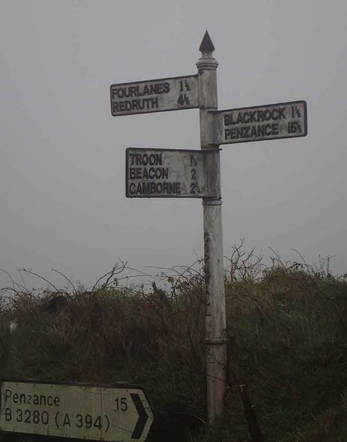
Image: © Milestone Society Taken: Unknown
Raised finial - G; by the B3286, in parish of Camborne (Kerrier District), opposite Troon turn, against bank, 1m from road edge. To be surveyed Milestone Society National ID: CW_SW6736.
Images are licensed for reuse under creativecommons.org/licenses/by-sa/2.0
Image Location


Leaflet Map data © OpenStreetMap
Latitude
50.185729
Longitude
-5.259278