Old Milestone by the B2189, Hartley Village, Cranbrook Parish
Introduction
The photograph on this page of Old Milestone by the B2189, Hartley Village, Cranbrook Parish by JR Dowding & C Woodward as part of the Geograph project.
The Geograph project started in 2005 with the aim of publishing, organising and preserving representative images for every square kilometre of Great Britain, Ireland and the Isle of Man.

There are currently over 7.5m images from over 14,400 individuals and you can help contribute to the project by visiting https://www.geograph.org.uk
Old Milestone by the B2189, Hartley Village, Cranbrook Parish
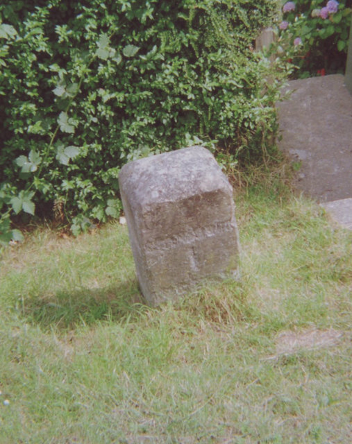
Image: © JR Dowding & C Woodward Taken: Unknown
Carved stone post by the B2189, in parish of CRANBROOK (TUNBRIDGE WELLS District), Hartley village, by "Pleasant View" (was Hartley House), on wide grass verge, on East side of road. Cranbrook stone, erected by the Maidstone & Cranbrook turnpike trust in the 19th century. Inscription reads:- (CRANBROOK) 1 (Defaced) Kent HER listed. HER Number: TQ 73 NE 327 https://www.heritagegateway.org.uk/Gateway/Results_Single.aspx?uid=MKE77280&resourceID=1005 Milestone Society National ID: KE_CBHH01.
Images are licensed for reuse under creativecommons.org/licenses/by-sa/2.0
Image Location
Latitude
51.087869
Longitude
0.514675