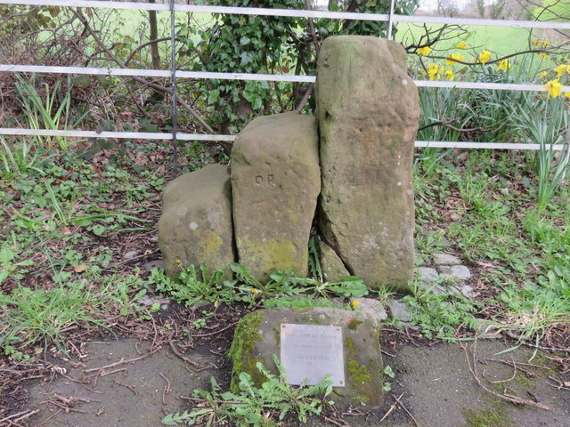
'The Wirral Stone', Willaston
Introduction
The photograph on this page of 'The Wirral Stone', Willaston by John S Turner as part of the Geograph project.
The Geograph project started in 2005 with the aim of publishing, organising and preserving representative images for every square kilometre of Great Britain, Ireland and the Isle of Man.
There are currently over 7.5m images from over 14,400 individuals and you can help contribute to the project by visiting https://www.geograph.org.uk

Image: © John S Turner Taken: 9 Apr 2016
The Wirral Stone stands alongside the B5151 Hadlow Road and is believed to mark the centre of The Wirral Hundred, and also be the origin of the name Willaston. This set of three stones, which would have served as horse mounting steps, stand at the junction of the B5151 and the A540 Chester High Road, which has been much widened over the years. As a result of the road alterations the stones have been moved at least once and were placed in this position in 1993 - Image There is an Ordnance Survey bench mark on the south west face of the tallest stone, but as the stone is out of place the cut mark is no longer on the Ordnance Survey database - Image

