The Bakery, Tomnahurich Street
Introduction
The photograph on this page of The Bakery, Tomnahurich Street by Craig Wallace as part of the Geograph project.
The Geograph project started in 2005 with the aim of publishing, organising and preserving representative images for every square kilometre of Great Britain, Ireland and the Isle of Man.

There are currently over 7.5m images from over 14,400 individuals and you can help contribute to the project by visiting https://www.geograph.org.uk
The Bakery, Tomnahurich Street
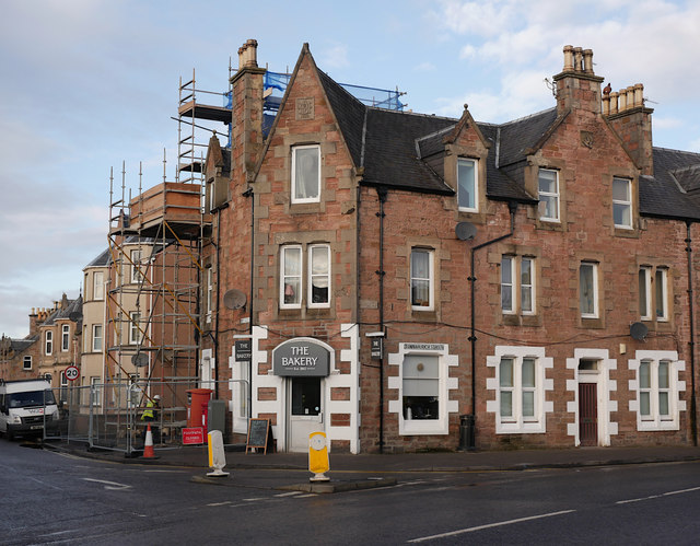
Image: © Craig Wallace Taken: 23 Jan 2019
At the junction of Tomnahurich Street and Montague Row. On the ground floor is The Bakery, with a pair of postboxes to the left. The stone on top of the building says AMcD 1888. Last week there was debris falling from the roof, with concerns for an unstable chimney. There is now scaffolding up, and the pavement is fenced off. https://www.pressandjournal.co.uk/fp/news/highlands/1652619/road-closure-after-debris-falls-property-on-montague-row/
Images are licensed for reuse under creativecommons.org/licenses/by-sa/2.0
Image Location
Latitude
57.474902
Longitude
-4.233367