The lake in Bishop's Park
Introduction
The photograph on this page of The lake in Bishop's Park by Marathon as part of the Geograph project.
The Geograph project started in 2005 with the aim of publishing, organising and preserving representative images for every square kilometre of Great Britain, Ireland and the Isle of Man.

There are currently over 7.5m images from over 14,400 individuals and you can help contribute to the project by visiting https://www.geograph.org.uk
The lake in Bishop's Park
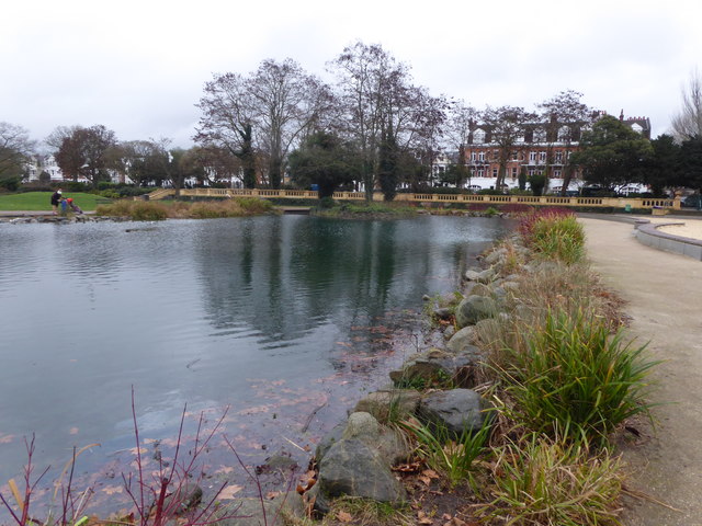
Image: © Marathon Taken: 16 Jan 2019
The adjacent river wall was built in three stages between 1893 and 1903 to the designs of Joseph Mears, the Borough Surveyor. The wall was built entirely of concrete and faced with rusticated concrete blocks. Once the river wall had been constructed, the area behind had to be filled in so local builders were invited to 'shoot at the Bishops' - that is to dump all manner of waste, so that the site could be levelled and grassed - see https://www.geograph.org.uk/photo/6028020 for a photograph of the river wall. That part of the park was then designed in 1903 by the Surveyor and Chief Engineer of Fulham Borough Council. The sweeping lake in Bishop's Park was enclosed on two sides by terracotta balustrading engraved with the monogram and crest of Fulham Borough Council.The rustic timber bridge gave access to a picnic and croquet lawn which was later turned into a small bowling green.The islands were the home to swans which were given by King Edward VIIth. The original form of the lake has now been restored and the rustic bridge, which was originally of timber, has now been recreated in more durable cast iron. The picnic area has been returned to lawn.
Images are licensed for reuse under creativecommons.org/licenses/by-sa/2.0
Image Location
Latitude
51.472035
Longitude
-0.218648