East Dulwich: phone box on a V-bend (or maybe a U-bend)
Introduction
The photograph on this page of East Dulwich: phone box on a V-bend (or maybe a U-bend) by Chris Downer as part of the Geograph project.
The Geograph project started in 2005 with the aim of publishing, organising and preserving representative images for every square kilometre of Great Britain, Ireland and the Isle of Man.

There are currently over 7.5m images from over 14,400 individuals and you can help contribute to the project by visiting https://www.geograph.org.uk
East Dulwich: phone box on a V-bend (or maybe a U-bend)
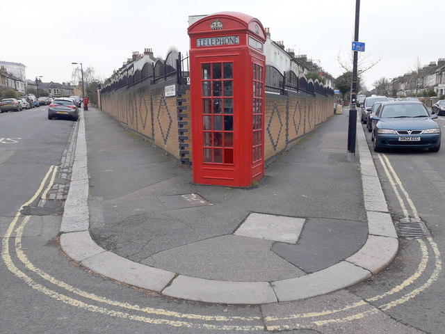
Image: © Chris Downer Taken: 19 Jan 2019
The acute angle of Upland Road and Friern Road allows an odd perspective, where the walls form an obvious V but the yellow lines are an almost perfect U. In reality, the angle is about 30°. The junction is home to a K2 phone box - essentially the predecessor to the more familiar K6, which still contains a phone and is probably therefore in working order.
Images are licensed for reuse under creativecommons.org/licenses/by-sa/2.0
Image Location
Latitude
51.455947
Longitude
-0.065978