Y Capel Saesneg - The English Chapel
Introduction
The photograph on this page of Y Capel Saesneg - The English Chapel by Gerald England as part of the Geograph project.
The Geograph project started in 2005 with the aim of publishing, organising and preserving representative images for every square kilometre of Great Britain, Ireland and the Isle of Man.

There are currently over 7.5m images from over 14,400 individuals and you can help contribute to the project by visiting https://www.geograph.org.uk
Y Capel Saesneg - The English Chapel
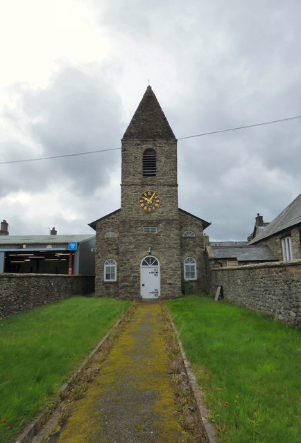
Image: © Gerald England Taken: 15 Sep 2018
The Grade II listed https://www.coflein.gov.uk/en/site/11653/details/english-presbyterian-chapel-high-street-bala English Presbyterian Chapel on High Street in Bala was built in 1810 as a Chapel of Ease. It is built in the Vernacular style with a gable entry plan, round headed windows and an integral tower and spire. This chapel served as Bala's only Anglican church until 1855 when it was converted for use as a school. It closed as a place of worship in 2017 http://www.cambrian-news.co.uk/article.cfm?id=119370&headline=End%20of%20an%20era%20as%20chapel%20closes%20its%20doors§ionIs=news&searchyear=2018
Images are licensed for reuse under creativecommons.org/licenses/by-sa/2.0
Image Location
Latitude
52.911133
Longitude
-3.596593