Disused railway, Harrington, West Cumbria
Introduction
The photograph on this page of Disused railway, Harrington, West Cumbria by Ralph Rawlinson as part of the Geograph project.
The Geograph project started in 2005 with the aim of publishing, organising and preserving representative images for every square kilometre of Great Britain, Ireland and the Isle of Man.

There are currently over 7.5m images from over 14,400 individuals and you can help contribute to the project by visiting https://www.geograph.org.uk
Disused railway, Harrington, West Cumbria
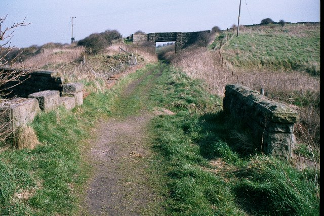
Image: © Ralph Rawlinson Taken: 2 Apr 2002
Traffic on the Harrington & Lowca Light Railway was mainly minerals but passengers were carried between 1913 and 1926. This is the site of the former Rosehill Archer Street station where southbound trains were faced with a cruel 285 yds at 1 in 17. In bad weather trains had to set back towards Church Road in order to have a run at the bank. It was the steepest gradient in Britain to have carried adhesion worked passenger trains.
Images are licensed for reuse under creativecommons.org/licenses/by-sa/2.0
Image Location
Latitude
54.610944
Longitude
-3.563791