SSW view along Waterloo Crescent
Introduction
The photograph on this page of SSW view along Waterloo Crescent by John Baker as part of the Geograph project.
The Geograph project started in 2005 with the aim of publishing, organising and preserving representative images for every square kilometre of Great Britain, Ireland and the Isle of Man.

There are currently over 7.5m images from over 14,400 individuals and you can help contribute to the project by visiting https://www.geograph.org.uk
SSW view along Waterloo Crescent
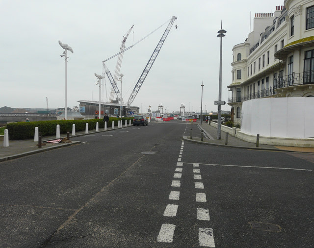
Image: © John Baker Taken: 28 Dec 2018
Behind the Dover Sea Sports Centre (the building on the left), are the two jibs of a Baldwins crane, which is being used to manoeuvre the deck/roadway of a bascule bridge into position over a navigational cut. The towers of the bridge are at the end of the road. More images of the navigational cut, bascule bridge and Baldwins crane may be seen on http://www.doverforum.com/sea-news/
Images are licensed for reuse under creativecommons.org/licenses/by-sa/2.0
Image Location
Latitude
51.120846
Longitude
1.31338