Chestnut Avenue
Introduction
The photograph on this page of Chestnut Avenue by Robin Webster as part of the Geograph project.
The Geograph project started in 2005 with the aim of publishing, organising and preserving representative images for every square kilometre of Great Britain, Ireland and the Isle of Man.

There are currently over 7.5m images from over 14,400 individuals and you can help contribute to the project by visiting https://www.geograph.org.uk
Chestnut Avenue
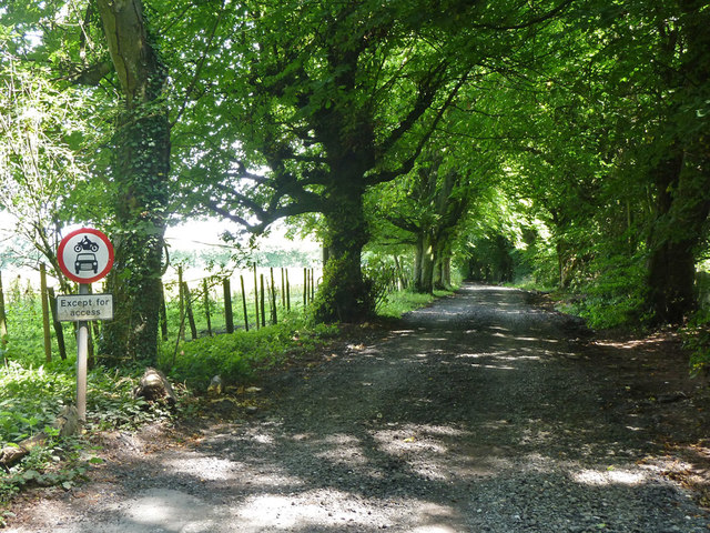
Image: © Robin Webster Taken: 31 Jul 2011
This eastern part is a private road but public bridleway. The sign in a little odd, as the route is mapped only as a public bridleway continuously through this point. It is, however, at the Surrey - Kent county boundary, so maybe the Kent as the onwards highway authority felt they ought to reassert the matter.
Images are licensed for reuse under creativecommons.org/licenses/by-sa/2.0
Image Location


Leaflet Map data © OpenStreetMap
Latitude
51.288192
Longitude
0.047435