St Austell, war memorial
Introduction
The photograph on this page of St Austell, war memorial by Stephen Craven as part of the Geograph project.
The Geograph project started in 2005 with the aim of publishing, organising and preserving representative images for every square kilometre of Great Britain, Ireland and the Isle of Man.

There are currently over 7.5m images from over 14,400 individuals and you can help contribute to the project by visiting https://www.geograph.org.uk
St Austell, war memorial
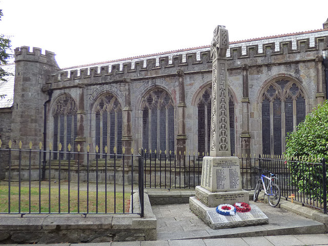
Image: © Stephen Craven Taken: 10 Aug 2018
The memorial is at the roadside outside the parish church of the Holy Trinity. It is listed grade II (list entry 1421321). The inscription on the main base of the memorial is "To the Glory of God and in sacred memory of the men of the ancient Parish of St Austell who made the supreme sacrifice in the Great War 1914-1918." The memorial was erected in the 1920s but it was not until 1991 that the names of the victims of WW2 were added to the sloping part of the base, with the inscription “and in memory of those of this area who lost their lives in the war of 1939-1945”.
Images are licensed for reuse under creativecommons.org/licenses/by-sa/2.0
Image Location


Leaflet Map data © OpenStreetMap
Latitude
50.338504
Longitude
-4.792125