Newtown bypass bridge
Introduction
The photograph on this page of Newtown bypass bridge by Penny Mayes as part of the Geograph project.
The Geograph project started in 2005 with the aim of publishing, organising and preserving representative images for every square kilometre of Great Britain, Ireland and the Isle of Man.

There are currently over 7.5m images from over 14,400 individuals and you can help contribute to the project by visiting https://www.geograph.org.uk
Newtown bypass bridge
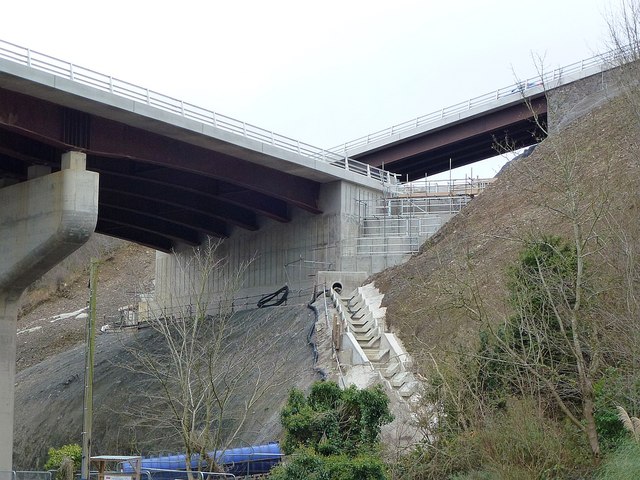
Image: © Penny Mayes Taken: 1 Jan 2019
Seen from Middle Dolfor Road. The bridge above it is on Upper Dolfor Road. The drainage channel seems very elaborate. For reciprocal views see https://www.geograph.org.uk/photo/5962985 and https://www.geograph.org.uk/photo/5962990 For drone footage of the installation of the roadway beams on this bridge see https://www.youtube.com/watch?v=FTQFNdgILME
Images are licensed for reuse under creativecommons.org/licenses/by-sa/2.0
Image Location
Latitude
52.502637
Longitude
-3.316407