Woodhouses Lane descending
Introduction
The photograph on this page of Woodhouses Lane descending by Trevor Littlewood as part of the Geograph project.
The Geograph project started in 2005 with the aim of publishing, organising and preserving representative images for every square kilometre of Great Britain, Ireland and the Isle of Man.

There are currently over 7.5m images from over 14,400 individuals and you can help contribute to the project by visiting https://www.geograph.org.uk
Woodhouses Lane descending
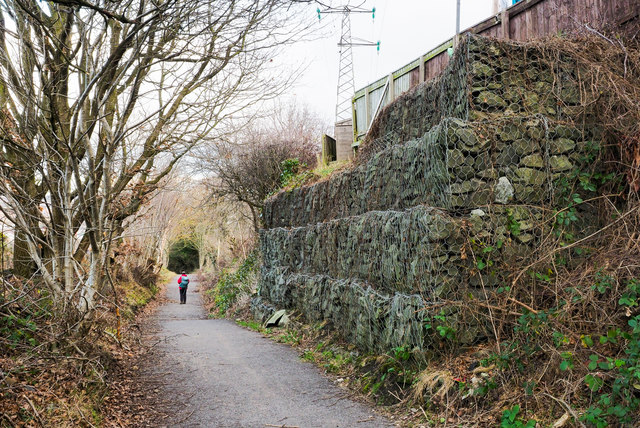
Image: © Trevor Littlewood Taken: 1 Jan 2019
Woodhouses Lane contours around the eastern slope of the Derwent valley, bounding the limit of housing on the western side of Whickham; it then descends to reach Swalwell. The slope is a steep one at the camera location and rock-filled cages - gabions - have been used as stabilisation.
Images are licensed for reuse under creativecommons.org/licenses/by-sa/2.0
Image Location
Latitude
54.947665
Longitude
-1.688199