Danby
Introduction
The photograph on this page of Danby by Mick Garratt as part of the Geograph project.
The Geograph project started in 2005 with the aim of publishing, organising and preserving representative images for every square kilometre of Great Britain, Ireland and the Isle of Man.

There are currently over 7.5m images from over 14,400 individuals and you can help contribute to the project by visiting https://www.geograph.org.uk
Danby
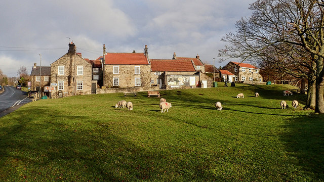
Image: © Mick Garratt Taken: 22 Dec 2018
A peaceful rural village scene. Sheep grazing on the green at Danby. The gable end on the left belongs to the Duke of Wellington Inn. According to the inn’s website, it dates to back beyond 1765 and was originally called the Red Briar and later the Lord Wellington, presumably, after 1815 when he became a national hero after his victory over Napoleon at the Battle of Waterloo. During that war, the inn was used as a recruiting post by local regiments. When the Canon Atkinson (him again!) arrived in 1847 to take up his position as Vicar of Danby the hostelry was called the Wellington Arms and was kept by two sisters known “far and wide” as Martha and Mary. A later landlord was John Elwine who died in 1918, according to Tom Scott Burns. The Danby burial register records “John Elwine (72 years old) many years at the Duke of Wellington. Dale End, latterly scavenger on the roads.” He must have fallen on hard times. From my blog http://www.fhithich.uk/?p=20595
Images are licensed for reuse under creativecommons.org/licenses/by-sa/2.0
Image Location


Leaflet Map data © OpenStreetMap
Latitude
54.468472
Longitude
-0.90912