Proposed development site, Crown Quay Lane
Introduction
The photograph on this page of Proposed development site, Crown Quay Lane by John Baker as part of the Geograph project.
The Geograph project started in 2005 with the aim of publishing, organising and preserving representative images for every square kilometre of Great Britain, Ireland and the Isle of Man.

There are currently over 7.5m images from over 14,400 individuals and you can help contribute to the project by visiting https://www.geograph.org.uk
Proposed development site, Crown Quay Lane
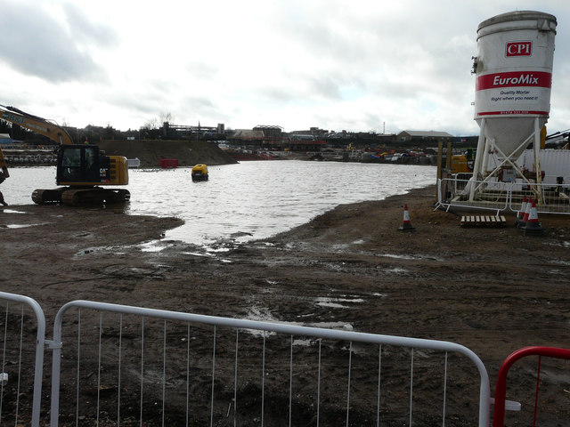
Image: © John Baker Taken: 2 Dec 2018
Planning permission has been granted by Swale Borough Council under application number 16/507877/FULL for the “erection of a residential development comprising 405 dwellings including associated access, parking, public open spaces and landscaping. New vehicular/pedestrian access from Eurolink Way and further secondary vehicular/pedestrian access off Crown Quay Lane. Associated drainage and earthworks”. The location was described as land to the west of Crown Quay Lane. This is the Image before any buildings were erected and the ground became so waterlogged, through rainfall, that a huge lake was formed.
Images are licensed for reuse under creativecommons.org/licenses/by-sa/2.0
Image Location
Latitude
51.344075
Longitude
0.74064