Claxfield House, London Road
Introduction
The photograph on this page of Claxfield House, London Road by John Baker as part of the Geograph project.
The Geograph project started in 2005 with the aim of publishing, organising and preserving representative images for every square kilometre of Great Britain, Ireland and the Isle of Man.

There are currently over 7.5m images from over 14,400 individuals and you can help contribute to the project by visiting https://www.geograph.org.uk
Claxfield House, London Road
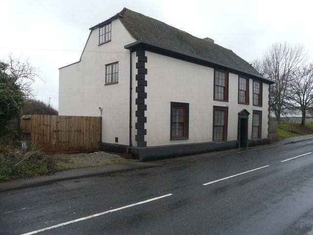
Image: © John Baker Taken: 2 Dec 2018
It is a grade II listed building that was once a house but was converted into offices. It is timber framed and dates from the 17th century but was refaced (plastered) in the 18th century. It has a plain tiled roof https://britishlistedbuildings.co.uk/101343927-claxfield-house-lynsted-with-kingsdown#.WA5Ahf4zXcc This was Image before it was restored but it remains uninhabited.
Images are licensed for reuse under creativecommons.org/licenses/by-sa/2.0
Image Location
Latitude
51.330057
Longitude
0.789621