Central Hill Estate, Lunham Road
Introduction
The photograph on this page of Central Hill Estate, Lunham Road by Stephen Richards as part of the Geograph project.
The Geograph project started in 2005 with the aim of publishing, organising and preserving representative images for every square kilometre of Great Britain, Ireland and the Isle of Man.

There are currently over 7.5m images from over 14,400 individuals and you can help contribute to the project by visiting https://www.geograph.org.uk
Central Hill Estate, Lunham Road
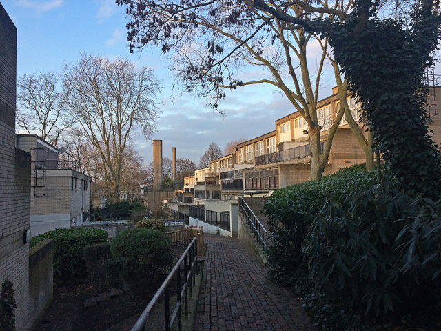
Image: © Stephen Richards Taken: 14 Dec 2018
Plane Tree Walk in weak late afternoon sunshine. The estate was put up by Lambeth Council in 1967-74 (in the days when local authorities employed architects and built public housing). Pevsner comments that it is "stylistically still very much in the International Modern tradition...with ingenious planning it was possible to give all the flats front doors at ground level, reached by paths along the contours of the hill". Many flats have excellent views towards central London. Despite all that, in what is becoming a sadly familiar tale, Lambeth wants to demolish all 450 homes on the estate so that it can build private ones, the sale of which will fund new social housing. Residents seem to oppose the plan, presumably because they will be scattered to the four winds. A Twentieth Century Society bid to have the estate listed failed.
Images are licensed for reuse under creativecommons.org/licenses/by-sa/2.0
Image Location
Latitude
51.420654
Longitude
-0.085304