Cromartie Buildings, Strathpeffer
Introduction
The photograph on this page of Cromartie Buildings, Strathpeffer by Richard Dorrell as part of the Geograph project.
The Geograph project started in 2005 with the aim of publishing, organising and preserving representative images for every square kilometre of Great Britain, Ireland and the Isle of Man.

There are currently over 7.5m images from over 14,400 individuals and you can help contribute to the project by visiting https://www.geograph.org.uk
Cromartie Buildings, Strathpeffer
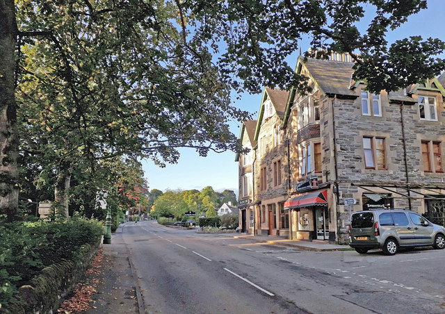
Image: © Richard Dorrell Taken: 8 Sep 2018
The substantial building on the right is named Cromartie House, and dates from 1885. It was built as a lodging house, and also housed Burnett's tea rooms which were served by a bakery which stood at the rear of the building (see Image]) and also Fraser's drapery shop, which closed in 1998. The lodging rooms were converted into flats in the 1920s.
Images are licensed for reuse under creativecommons.org/licenses/by-sa/2.0
Image Location
Latitude
57.589201
Longitude
-4.537538