Clayton Hall
Introduction
The photograph on this page of Clayton Hall by Gerald England as part of the Geograph project.
The Geograph project started in 2005 with the aim of publishing, organising and preserving representative images for every square kilometre of Great Britain, Ireland and the Isle of Man.

There are currently over 7.5m images from over 14,400 individuals and you can help contribute to the project by visiting https://www.geograph.org.uk
Clayton Hall
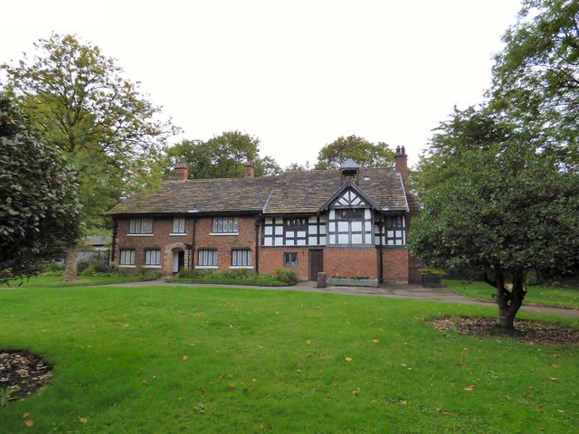
Image: © Gerald England Taken: 28 Aug 2018
The Grade II* listed https://historicengland.org.uk/listing/the-list/list-entry/1197795 Clayton Hall dates back to the 15th century.
Images are licensed for reuse under creativecommons.org/licenses/by-sa/2.0
Image Location
Latitude
53.483622
Longitude
-2.18019