Former coach house at Waters Upton Hall
Introduction
The photograph on this page of Former coach house at Waters Upton Hall by Richard Law as part of the Geograph project.
The Geograph project started in 2005 with the aim of publishing, organising and preserving representative images for every square kilometre of Great Britain, Ireland and the Isle of Man.

There are currently over 7.5m images from over 14,400 individuals and you can help contribute to the project by visiting https://www.geograph.org.uk
Former coach house at Waters Upton Hall
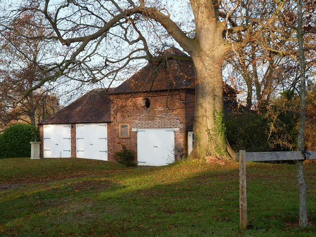
Image: © Richard Law Taken: 17 Nov 2018
Putting aside the modern double garage to the left, the main building here with the pyramidal roof and hayloft, is the former coach house to the hall, which dates from the 18th century, and which was Grade II listed https://britishlistedbuildings.co.uk/101033313-coach-house-south-east-of-hall-waters-upton#.XBGGR9SLTGg in 1983.
Images are licensed for reuse under creativecommons.org/licenses/by-sa/2.0
Image Location
Latitude
52.771843
Longitude
-2.543793