Fir Tree cottage, Waters Upton
Introduction
The photograph on this page of Fir Tree cottage, Waters Upton by Richard Law as part of the Geograph project.
The Geograph project started in 2005 with the aim of publishing, organising and preserving representative images for every square kilometre of Great Britain, Ireland and the Isle of Man.

There are currently over 7.5m images from over 14,400 individuals and you can help contribute to the project by visiting https://www.geograph.org.uk
Fir Tree cottage, Waters Upton
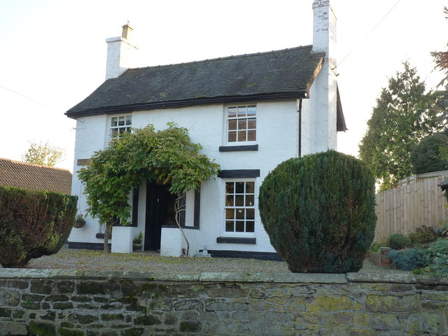
Image: © Richard Law Taken: 17 Nov 2018
An early 19th century, sandstone ashlar cottage, which was Grade II listed https://britishlistedbuildings.co.uk/101033312-fir-tree-waters-upton#.XBGBJ9SLTGg in 1983
Images are licensed for reuse under creativecommons.org/licenses/by-sa/2.0
Image Location
Latitude
52.771308
Longitude
-2.542897