Possil Station Approach
Introduction
The photograph on this page of Possil Station Approach by Raymond Okonski as part of the Geograph project.
The Geograph project started in 2005 with the aim of publishing, organising and preserving representative images for every square kilometre of Great Britain, Ireland and the Isle of Man.

There are currently over 7.5m images from over 14,400 individuals and you can help contribute to the project by visiting https://www.geograph.org.uk
Possil Station Approach
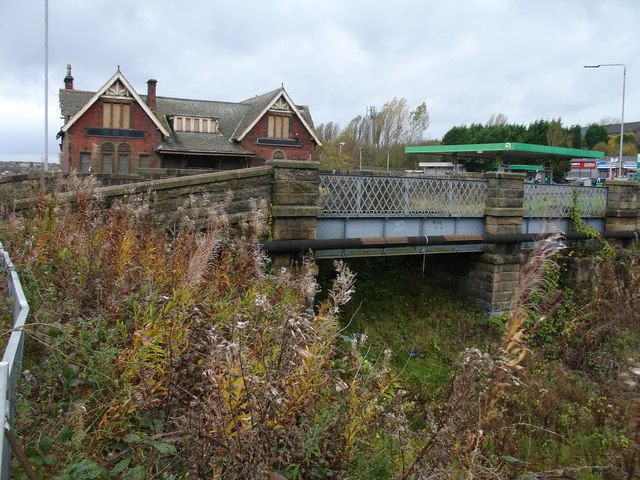
Image: © Raymond Okonski Taken: 31 Oct 2007
The cutting is largely overgrown, and the bridge has been backfilled with earth. Looking eastwards to the station building, the road bridge (at the station building) has sandstone parapets, however the bridge closest to camera uses a traditional iron lattice, so whether this was initially double-width for road use then subsequently ignored, or the road was realigned after the station was built is unclear. Possil was a terminus for all passenger services on this line - only goods trains continued under the bridge heading east to Springburn Park (Goods) Station, Stobhill, and on to the main line junction near Hogganfield Loch.
Images are licensed for reuse under creativecommons.org/licenses/by-sa/2.0
Image Location
Latitude
55.892804
Longitude
-4.260427