
Crickback Bridge, Chew Magna
Introduction
The photograph on this page of Crickback Bridge, Chew Magna by Derek Harper as part of the Geograph project.
The Geograph project started in 2005 with the aim of publishing, organising and preserving representative images for every square kilometre of Great Britain, Ireland and the Isle of Man.

There are currently over 7.5m images from over 14,400 individuals and you can help contribute to the project by visiting https://www.geograph.org.uk
Crickback Bridge, Chew Magna
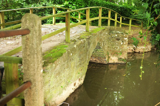
Image: © Derek Harper Taken: 18 Sep 2018
The upstream side of the listed bridge https://historicengland.org.uk/listing/the-list/list-entry/1268326 shown in Image There are two footbridges within about 70 metres of each other on the very short bridleway CL 3/83, itself no more than 90 metres long, but my GPS reading does not match the GR given by Historic England, which maps the eastern bridge, over a smaller channel of the river, as the listed structure, whereas my reading on this visit, and that of Neil's and Don's photos at https://www.geograph.org.uk/gridref/ST5762?centi=ST572629 , suggest it is the western bridge that is listed.
Images are licensed for reuse under creativecommons.org/licenses/by-sa/2.0
Image Location

Latitude
51.363909
Longitude
-2.614995