The riverfront at Purfleet
Introduction
The photograph on this page of The riverfront at Purfleet by Marathon as part of the Geograph project.
The Geograph project started in 2005 with the aim of publishing, organising and preserving representative images for every square kilometre of Great Britain, Ireland and the Isle of Man.

There are currently over 7.5m images from over 14,400 individuals and you can help contribute to the project by visiting https://www.geograph.org.uk
The riverfront at Purfleet
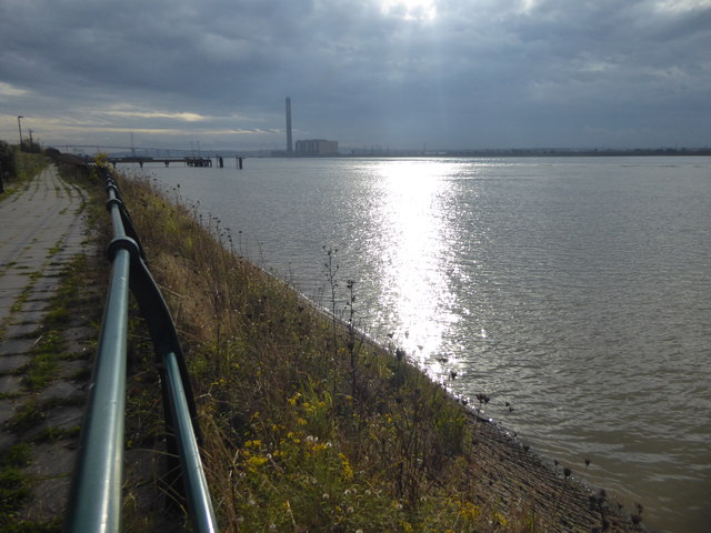
Image: © Marathon Taken: 6 Nov 2018
The sun breaks through the clouds to throw a shaft of light on to the River Thames. The chimney of Littlebrook Power Station, the fourth highest in the UK, is ahead with the QE II Bridge just visible to the left.
Images are licensed for reuse under creativecommons.org/licenses/by-sa/2.0
Image Location


Leaflet Map data © OpenStreetMap
Latitude
51.480958
Longitude
0.232055