Nettlehirst from the air
Introduction
The photograph on this page of Nettlehirst from the air by Thomas Nugent as part of the Geograph project.
The Geograph project started in 2005 with the aim of publishing, organising and preserving representative images for every square kilometre of Great Britain, Ireland and the Isle of Man.

There are currently over 7.5m images from over 14,400 individuals and you can help contribute to the project by visiting https://www.geograph.org.uk
Nettlehirst from the air
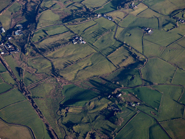
Image: © Thomas Nugent Taken: 3 Dec 2018
The low winter sunlight reveals the scars of the former limestone quarry at Nettlehirst. Dusk Water meanders down the left side of the photo. See also Image & Image
Images are licensed for reuse under creativecommons.org/licenses/by-sa/2.0
Image Location
Latitude
55.71924
Longitude
-4.605798