Barton Path, Charlton, Dover
Introduction
The photograph on this page of Barton Path, Charlton, Dover by pam fray as part of the Geograph project.
The Geograph project started in 2005 with the aim of publishing, organising and preserving representative images for every square kilometre of Great Britain, Ireland and the Isle of Man.

There are currently over 7.5m images from over 14,400 individuals and you can help contribute to the project by visiting https://www.geograph.org.uk
Barton Path, Charlton, Dover
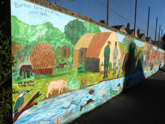
Image: © pam fray Taken: 4 Dec 2018
The path was built on Barton Manor farmland and the mural was painted by pupils of Barton, Charlton and Dover Girls Grammar Schools in 2011 under the supervision of local artist, Anita Luckett. It depicts the farm and then people through history up until 2011. Behind this section of wall is Barton School. The River Dour is to the right.
Images are licensed for reuse under creativecommons.org/licenses/by-sa/2.0
Image Location
Latitude
51.134733
Longitude
1.302651