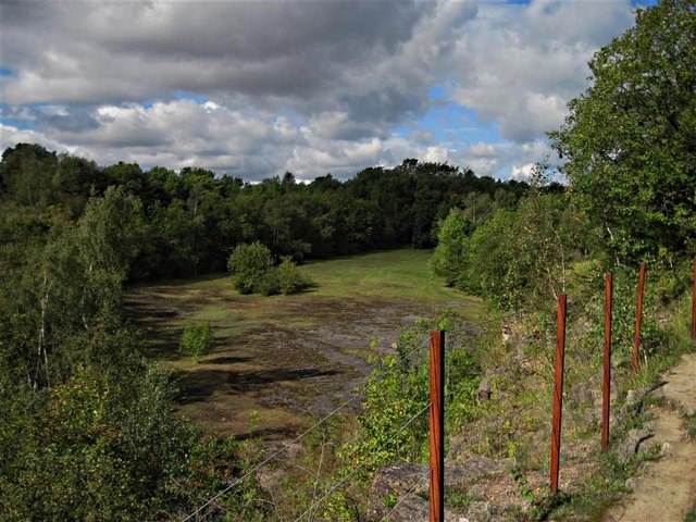
Lindrick Dale Quarry
Introduction
The photograph on this page of Lindrick Dale Quarry by Mike Nield as part of the Geograph project.
The Geograph project started in 2005 with the aim of publishing, organising and preserving representative images for every square kilometre of Great Britain, Ireland and the Isle of Man.
There are currently over 7.5m images from over 14,400 individuals and you can help contribute to the project by visiting https://www.geograph.org.uk

Image: © Mike Nield Taken: 19 Sep 2012
Lindrick Dale Quarry is a disused Magnesian limestone quarry, highly valued for its notable invertebrate fauna. The quarry also hosts diverse limestone flora, containing many typically ‘lime-loving’ plants. Several of the invertebrate species found here are rare or declining. A public footpath runs right through the quarry, entering at the lower right of this picture and then along the grassy floor into the woodland at the far end. There, the path climbs steadily before turning to follow the cliff edge, hidden here by the vegetation. On reaching the head of the quarry, the path turns sharply, offering this view before disappearing into Moses Seat Wood. The main access to the quarry is from Lindrick Dale off the A57 South Anston to Worksop road, but on foot can also be accessed from Bridge 35 (Thorpe Locks Bridge) on the Chesterfield Canal and crossing Fan Field to the head of the dale.

