Overgrown former Tabor church, Maesycwmmer
Introduction
The photograph on this page of Overgrown former Tabor church, Maesycwmmer by Jaggery as part of the Geograph project.
The Geograph project started in 2005 with the aim of publishing, organising and preserving representative images for every square kilometre of Great Britain, Ireland and the Isle of Man.

There are currently over 7.5m images from over 14,400 individuals and you can help contribute to the project by visiting https://www.geograph.org.uk
Overgrown former Tabor church, Maesycwmmer
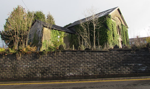
Image: © Jaggery Taken: 30 Nov 2018
The derelict building above the east side of Tabor Road dates from 1876. The building was Grade II(star) listed in 1997. Listed status is no guarantee that a building will be kept in a good state of repair.
Images are licensed for reuse under creativecommons.org/licenses/by-sa/2.0
Image Location


Leaflet Map data © OpenStreetMap
Latitude
51.645097
Longitude
-3.221464