Primark (Bank Buildings) fire, Belfast - December 2018(3)
Introduction
The photograph on this page of Primark (Bank Buildings) fire, Belfast - December 2018(3) by Albert Bridge as part of the Geograph project.
The Geograph project started in 2005 with the aim of publishing, organising and preserving representative images for every square kilometre of Great Britain, Ireland and the Isle of Man.

There are currently over 7.5m images from over 14,400 individuals and you can help contribute to the project by visiting https://www.geograph.org.uk
Primark (Bank Buildings) fire, Belfast - December 2018(3)
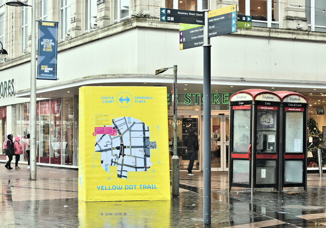
Image: © Albert Bridge Taken: 2 Dec 2018
The “Yellow Dot Trail” is a way of guiding people around around that part of the city centre closed following the Primark (Bank Buildings) fire. Yellow dots, on the footpaths, are supplemented by ones on lampposts and by street maps. This map is at Castle Place/Cornmarket/High Street.
Images are licensed for reuse under creativecommons.org/licenses/by-sa/2.0
Image Location
Latitude
54.599275
Longitude
-5.928736