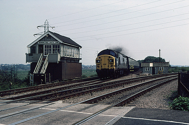
Manningtree South Junction
Introduction
The photograph on this page of Manningtree South Junction by Martin Addison as part of the Geograph project.
The Geograph project started in 2005 with the aim of publishing, organising and preserving representative images for every square kilometre of Great Britain, Ireland and the Isle of Man.
There are currently over 7.5m images from over 14,400 individuals and you can help contribute to the project by visiting https://www.geograph.org.uk

Image: © Martin Addison Taken: Unknown
The driver of crosseyed 37052 cracks on the power - clearly not stopping at Manningtree! Taken before the electrification of the Ipswich and Norwich line, this Junction forms the western end of a triangle giving access to the Harwich Docks Branch, the tracks for which diverge to the right. The yellow speed limit sign advises drivers that the maximum speed around the curve to Harwich is 25mph. Behind is a platelayers hut with some permanent way maintenance equipment outside. The Signal box had been converted some years before from semaphore to colour light signalling. The signal box was removed when the line was electrified and the platelayers hut was replaced by power supply equipment. Compare with the current scene in Oxyman's photo from the same spot - Image

