Grand Union Canal in Loughborough, Leicestershire
Introduction
The photograph on this page of Grand Union Canal in Loughborough, Leicestershire by Roger Kidd as part of the Geograph project.
The Geograph project started in 2005 with the aim of publishing, organising and preserving representative images for every square kilometre of Great Britain, Ireland and the Isle of Man.

There are currently over 7.5m images from over 14,400 individuals and you can help contribute to the project by visiting https://www.geograph.org.uk
Grand Union Canal in Loughborough, Leicestershire
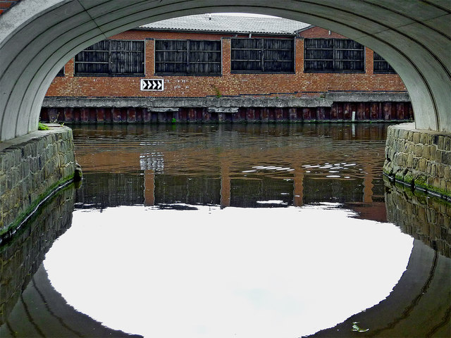
Image: © Roger Kidd Taken: 26 Aug 2013
This is a view through the arch of Chain Bridge, No 39B (counting from Freeman's Lock in Leicester) on the Grand Union Canal (Leicester Section). The navigation proceeds right at this junction. To the left is a short arm into the town centre. From here on the Loughborough Navigation continues to the River Soar and Trent, rather than the Leicester Navigation, which ends here.
Images are licensed for reuse under creativecommons.org/licenses/by-sa/2.0
Image Location


Leaflet Map data © OpenStreetMap
Latitude
52.776325
Longitude
-1.212951