27 Wyle Cop, Shrewsbury
Introduction
The photograph on this page of 27 Wyle Cop, Shrewsbury by Richard Law as part of the Geograph project.
The Geograph project started in 2005 with the aim of publishing, organising and preserving representative images for every square kilometre of Great Britain, Ireland and the Isle of Man.

There are currently over 7.5m images from over 14,400 individuals and you can help contribute to the project by visiting https://www.geograph.org.uk
27 Wyle Cop, Shrewsbury
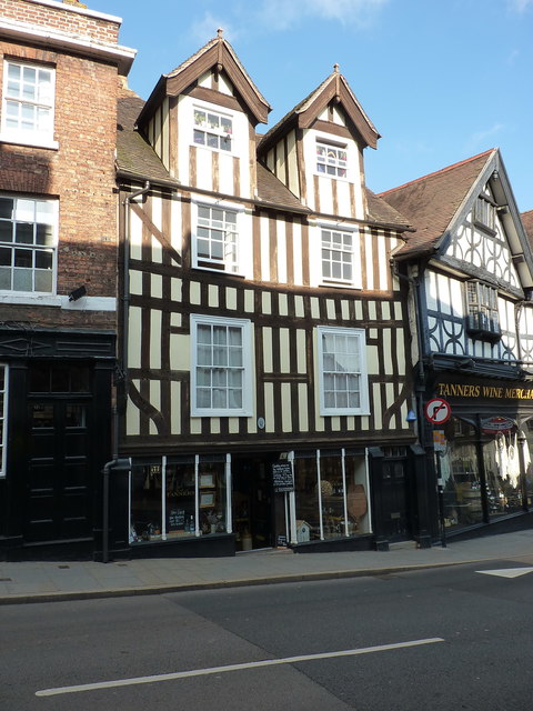
Image: © Richard Law Taken: 19 Oct 2018
Probably late 16th century, and Grade II listed https://britishlistedbuildings.co.uk/101254949-27-wyle-cop-shrewsbury#.XAOnv9SLTGg in 1953. This structure was originally built as a rather fine town house, and has latterly been converted, at least on the ground floor, to retail premises, and has been part of the Tanners Wine merchants for some years.
Images are licensed for reuse under creativecommons.org/licenses/by-sa/2.0
Image Location
Latitude
52.706352
Longitude
-2.749888