Development at the corner of Newbold Street and Newbold Terrace, Royal Leamington Spa
Introduction
The photograph on this page of Development at the corner of Newbold Street and Newbold Terrace, Royal Leamington Spa by Robin Stott as part of the Geograph project.
The Geograph project started in 2005 with the aim of publishing, organising and preserving representative images for every square kilometre of Great Britain, Ireland and the Isle of Man.

There are currently over 7.5m images from over 14,400 individuals and you can help contribute to the project by visiting https://www.geograph.org.uk
Development at the corner of Newbold Street and Newbold Terrace, Royal Leamington Spa
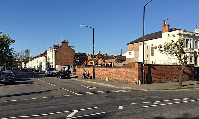
Image: © Robin Stott Taken: 4 Oct 2018
The site with the diggers was originally the garden of No 27 Newbold Street whose gable end is seen half left. A map of 1939 shows the plot divided, with a house on the nearer part. By 1952 it had been extended towards Newbold Terrace, foreground. Of red brick, it was out of keeping with its neighbours: it shows to the right of the clock tower in Image Now it's gone. Two planning applications for a dwelling on the site have been withdrawn; permission for a double garage has been granted. Building in progress: Image
Images are licensed for reuse under creativecommons.org/licenses/by-sa/2.0
Image Location
Latitude
52.289133
Longitude
-1.53081