Con O'Neill's Bridge, Belfast (November 2018)
Introduction
The photograph on this page of Con O'Neill's Bridge, Belfast (November 2018) by Albert Bridge as part of the Geograph project.
The Geograph project started in 2005 with the aim of publishing, organising and preserving representative images for every square kilometre of Great Britain, Ireland and the Isle of Man.

There are currently over 7.5m images from over 14,400 individuals and you can help contribute to the project by visiting https://www.geograph.org.uk
Con O'Neill's Bridge, Belfast (November 2018)
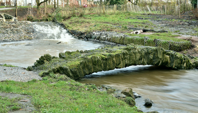
Image: © Albert Bridge Taken: 29 Nov 2018
The Connswater, looking upstream, high and muddy, after nearly three days of almost continuous rain, flowing under Con O’Neill’s Bridge. Image shows the river at a much lower level.
Images are licensed for reuse under creativecommons.org/licenses/by-sa/2.0
Image Location
Latitude
54.591423
Longitude
-5.890299